CSCE Capstone
Student Site for Individual and Collaborative Activites
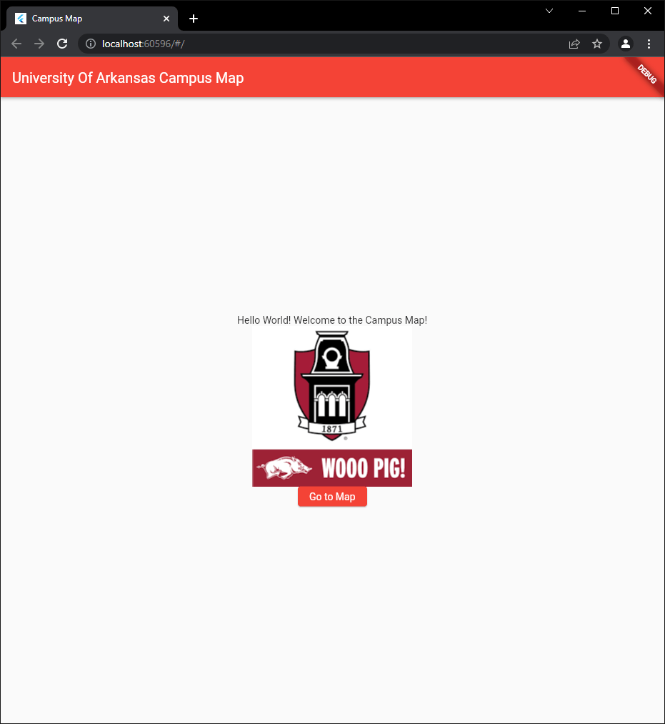
Team 20 – Campus Map
Team Members:
Robert Bell
Caleb Parks
Michael Luster
Tyler Saitang
Mena Anderson
Description:
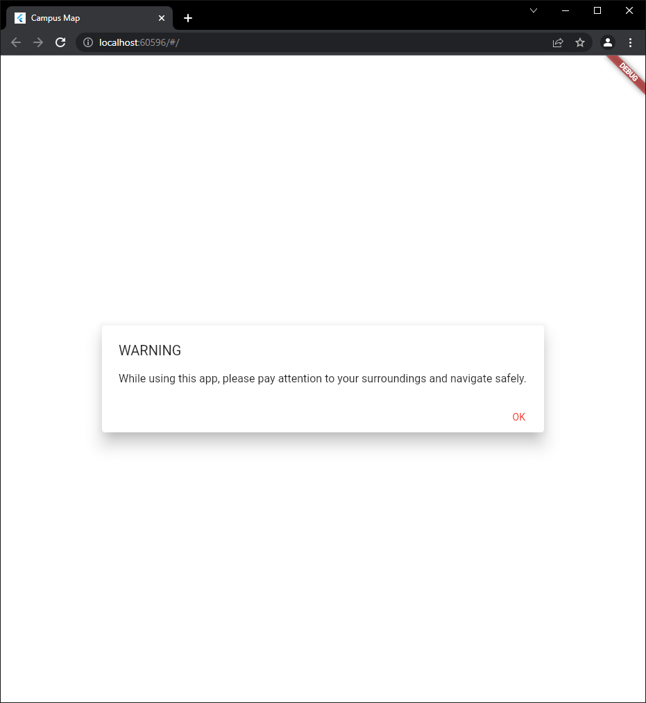
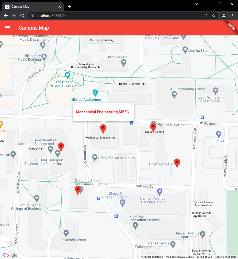
The problem is that there is not an application to help students who may not have time to find their respective classes before school starts. The objective is to be able to give students a view of the campus to help students be able to navigate to their classrooms without having to step on campus or risk being late to class. The significance of the project is to be able to have students, parents, faculty, and guests be able to find their way around campus easier.
Project Proposal:
Project Proposal Presentation:
Final Report:
Final Presentation:
Poster:
Source Code (GitHub):
Meeting Attendance:
Task List:
Schedule:
|
Learn the Flutter for Android toolkit that we will use to develop our application. |
1/3 – 1/9 |
|
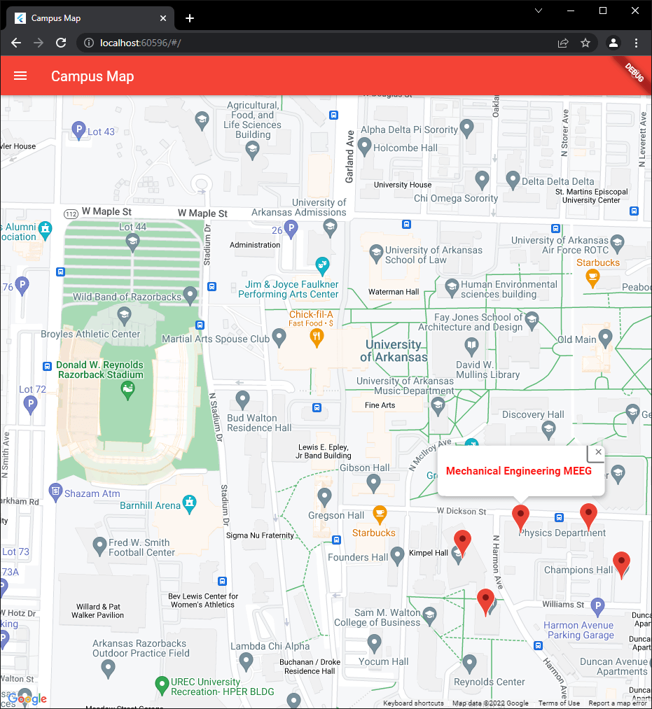
Create a Flutter application that will show a map view of the campus as a whole with foundational functionality. Display a view similar to related mainstream applications with buildings and roads/sidewalks. This map must notify users to be aware of their surroundings while navigating. |
1/10 – 1/23 |
|
Create a system in the application that can save and retrieve “class” objects and map information. These objects will need to persist in app storage. |
1/10 – 1/23 |
|
Extend the app to label individual buildings and open a new view per building. Views will be implemented fully at a later task, this deadline only requires that an interactive view be created on interaction with a building in the campus map. |
1/24 – 2/13 |
|
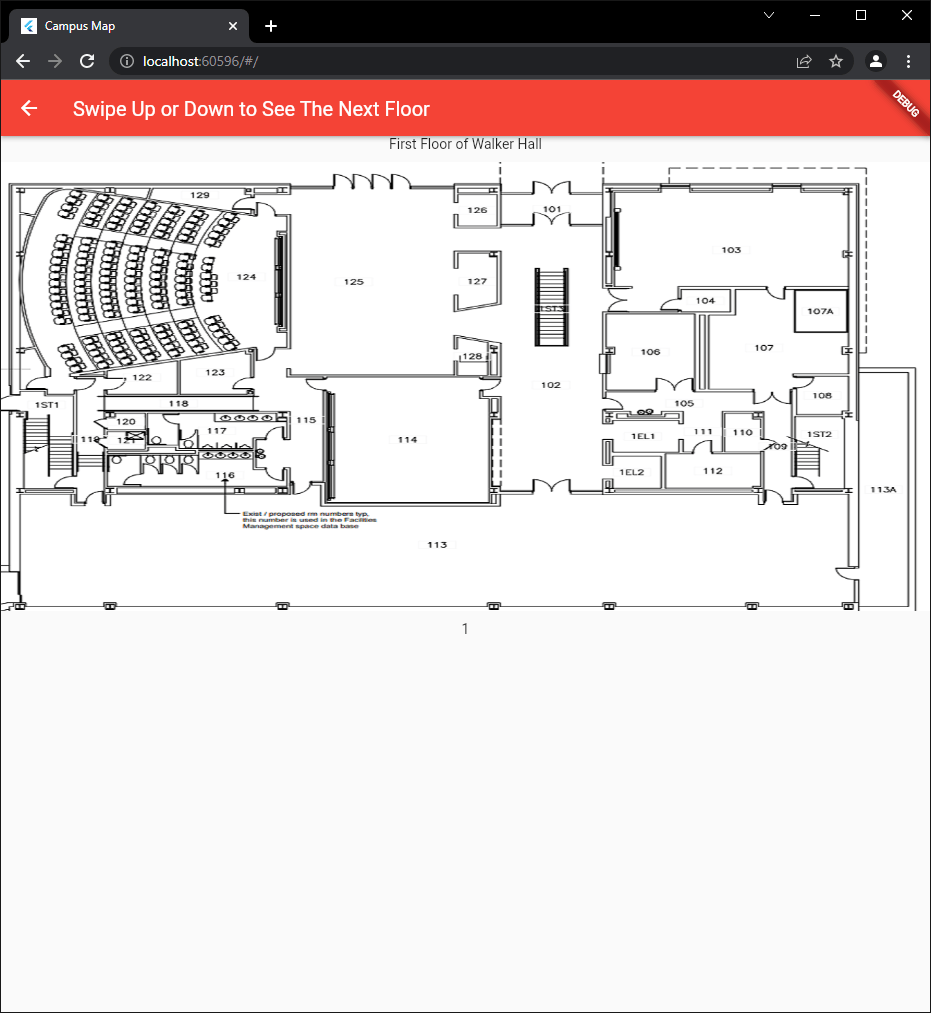
Render a scrollable map in the building view and implement a multi-level floor plan for building views. These views should implement a tree of viable classrooms, transition points, and hallways. Transition points are stairwells, exits, and any other means of leaving the current floor of a building. |
1/24 – 2/13 |
|
Implement in the individual map views entry points of a building denoted by floor, street facing, and by cardinal direction. Include pins on the map that will mark desired destinations specified in the user route. |
2/14 – 2/27 |
|
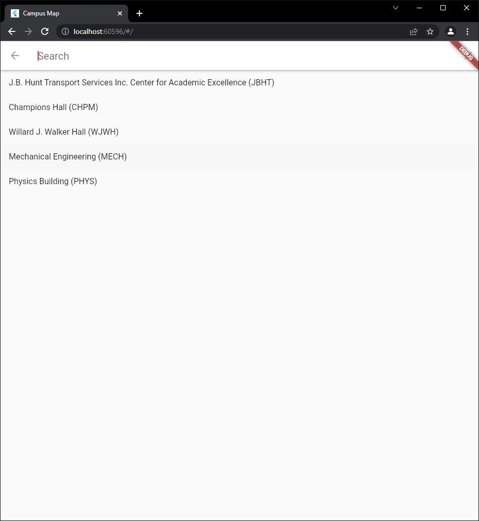
Implement a user interface such that the user can build a route by searching for building name and then by room number (BELL then 3160 for example). |
2/14 – 2/27 |
|
Create route planning functionality accessible through the user interface that uses the route structure from task 8. This task will be implemented as direct lines drawn from the current location to the desired room. |
2/28 – 3/13 |
|
Implement a dynamic route planner using a heuristic maze search algorithm. This task will require use of classrooms, transition points (read stairwells and exits), and halls as nodes. |
3/14 – 3/27 |
|
Extra time will be dedicated to final passes on all features completed up to this point, as well as documentation of code and features that may have received minimal description. |
3/28 – 4/18 |
Contact:
Robert Bell – robell@uark.edu
Caleb Parks – mjp016@uark.edu
Michael Luster – moluster@uark.edu
Tyler Saitang – txsaitan@uark.edu
Mena Anderson – fwanders@uark.edu